
Spatial analysis projects
11 projects tagged Spatial analysis, each with the problem and what I did.
Projects
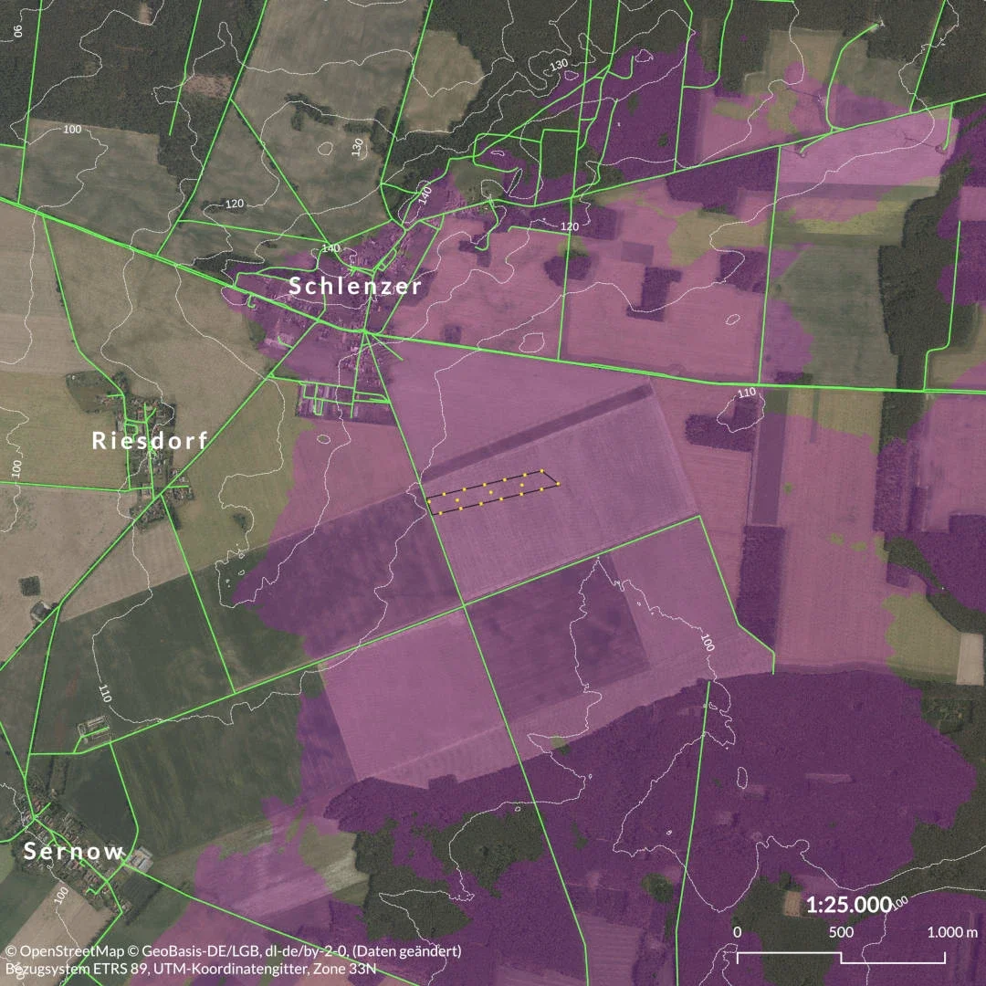
Solar park visibility analysis
Blueberry Energy, 2024
Viewshed maps for a planning application in Brandenburg
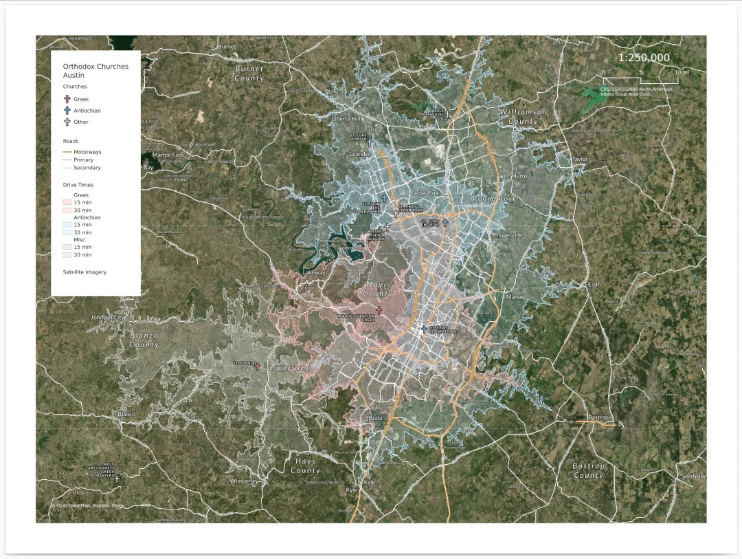
Site-selection maps for a church in Texas
RubiCrown Commercial Real Estate, 2024
Income and drive-time maps for placing a new church
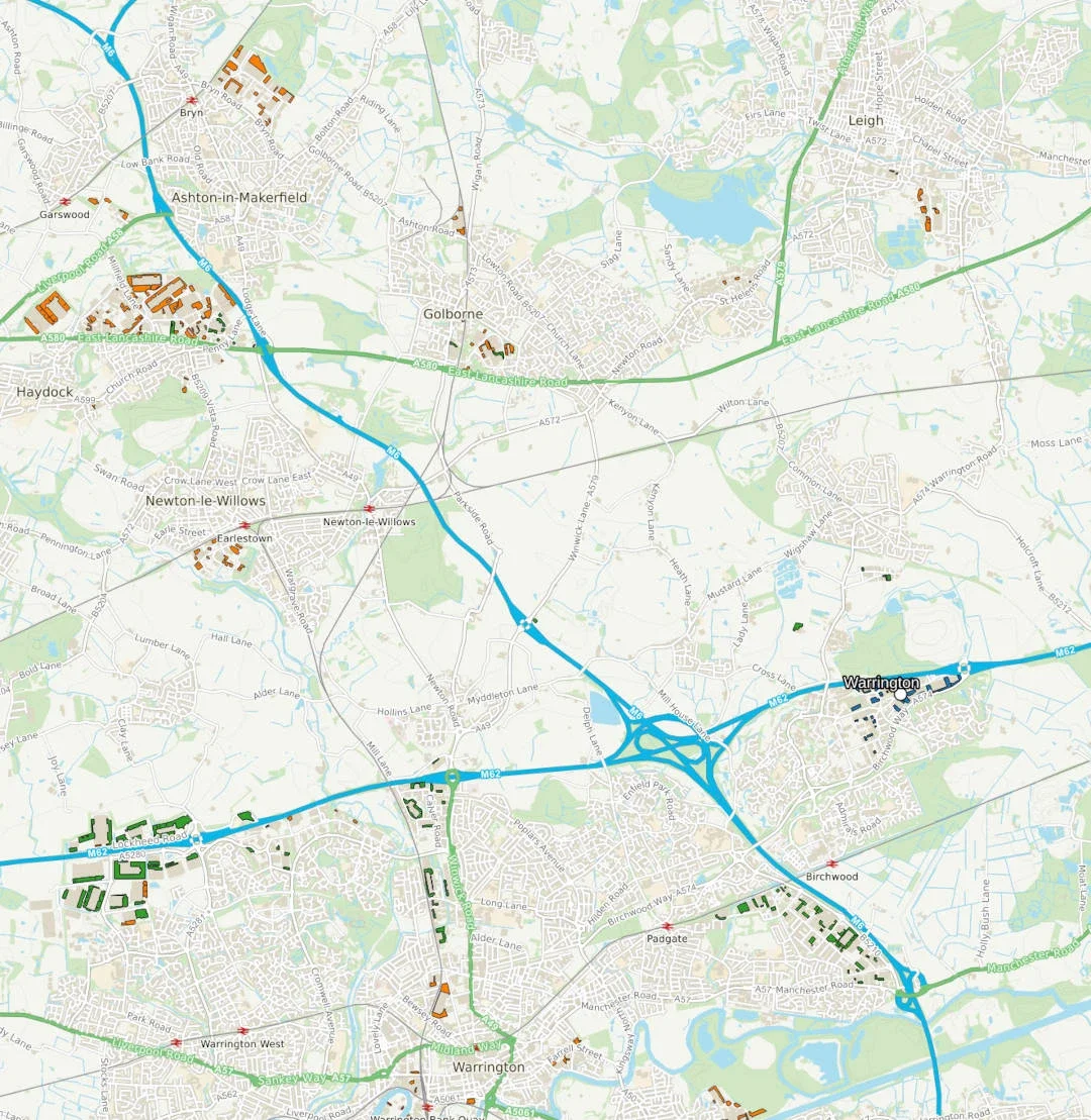
Travel times for industry
Aegis Energy, 2023
Isochrones showing access to target facilities across the UK
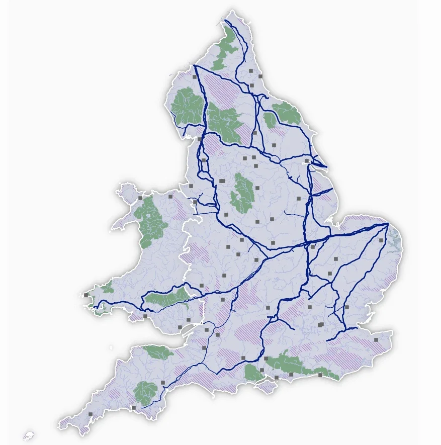
Infrastructure map in QGIS
Aegis Energy, 2022
UK gas pipelines and related infrastructure in one project
Geoprocessing tools for line networks
Outdooractive, 2020
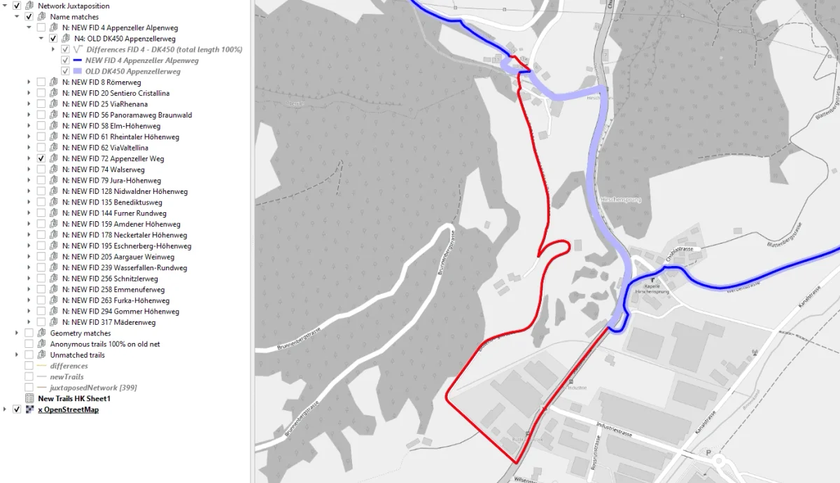
A PyQGIS tool that checks new trails against the existing network
Market penetration map for a security provider
Verisure Glasgow, 2019
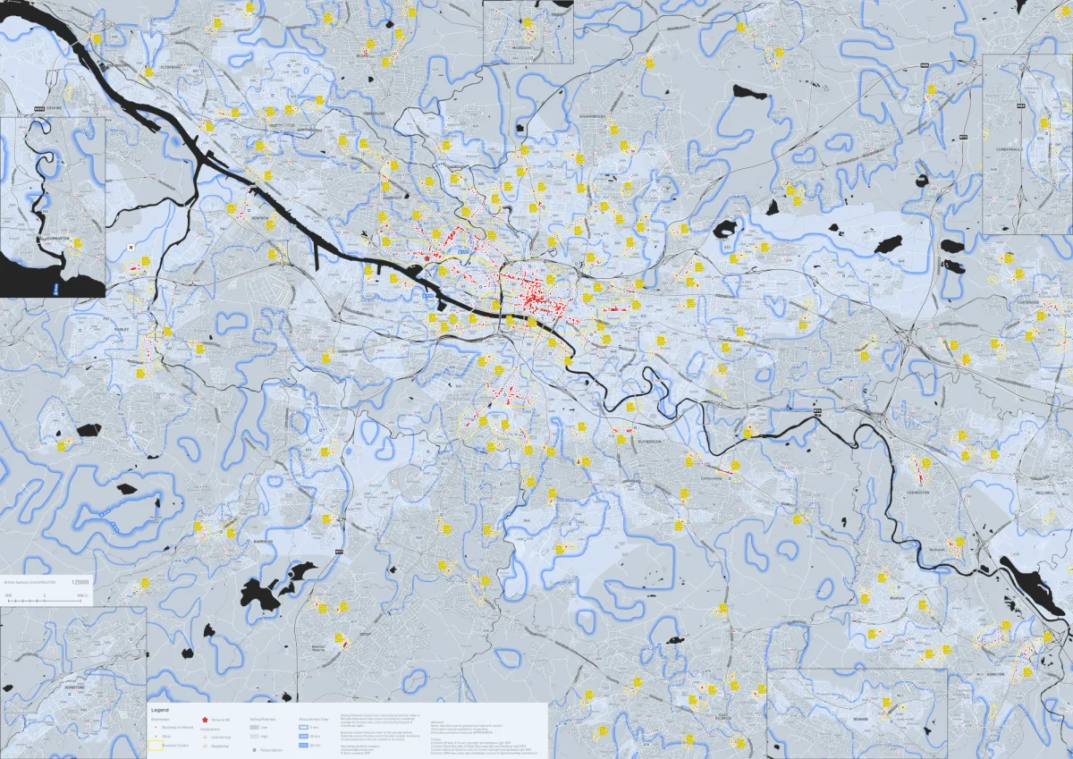
Ranking Glasgow areas by selling potential from open data
Mapping urban problems with AI
University of Glasgow, 2019
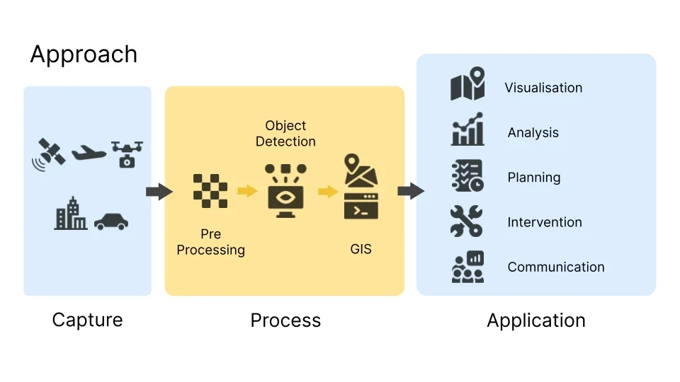
Published research on spotting urban problems in satellite imagery
Windfarm visual impact analysis
University of Glasgow, 2018
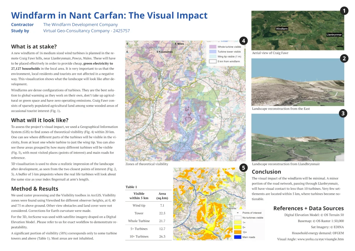
Viewshed analysis and an animated 3D video for a council hearing
Windfarm siting algorithm
Coursera, 2017
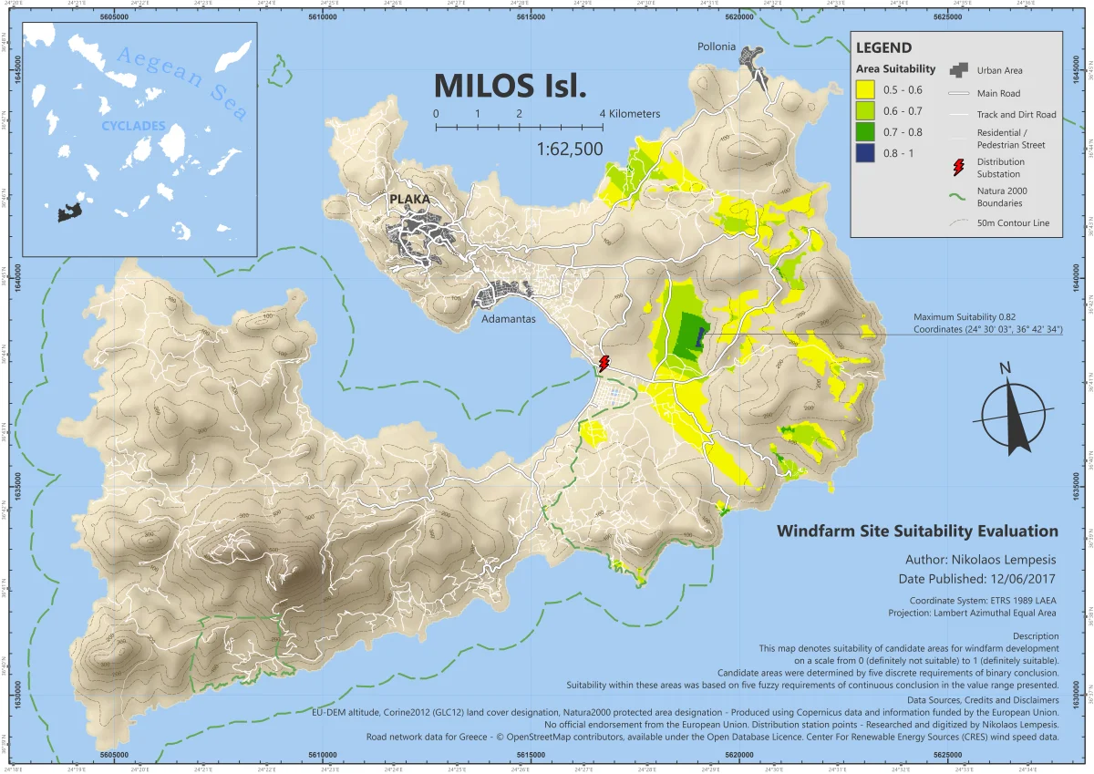
Multi-criteria site search on two Greek islands, automated in ModelBuilder
Automatic image classifications
2017
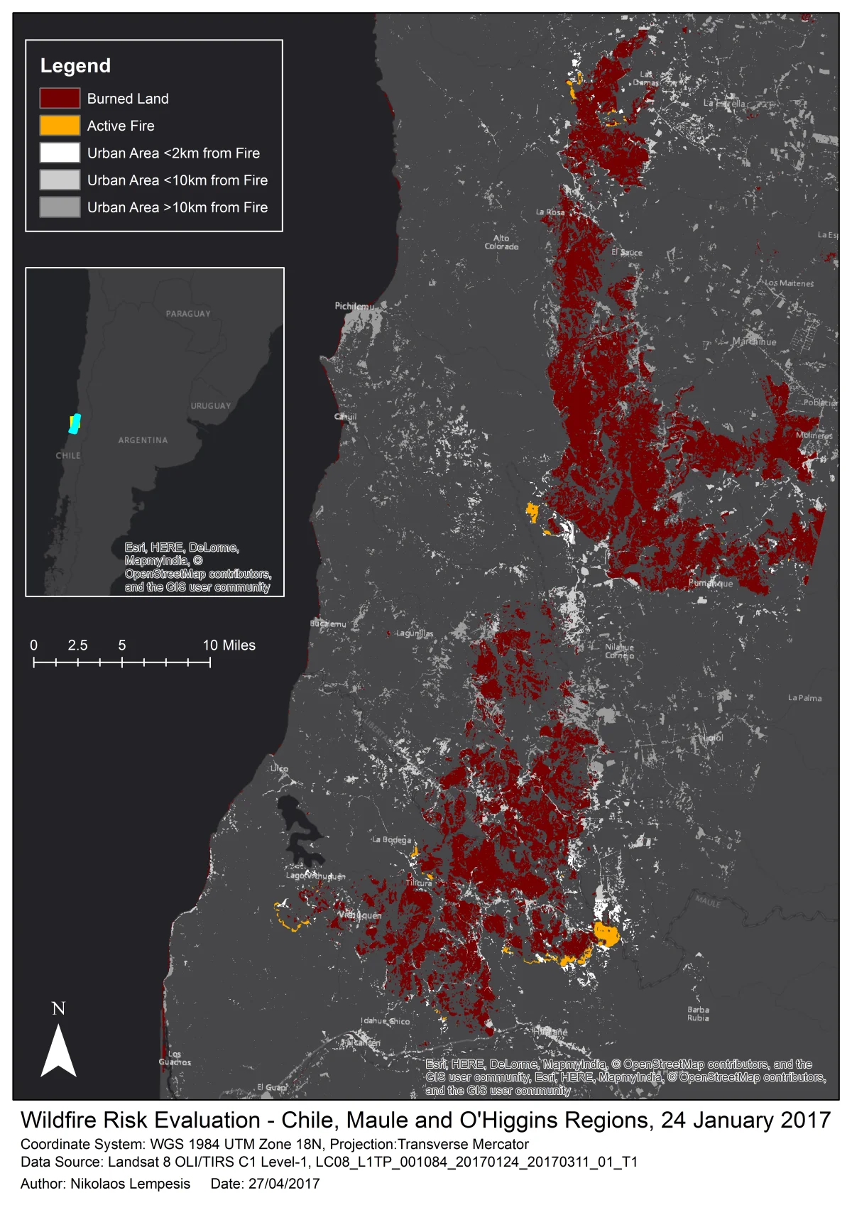
Wildfires in Chile and a shrinking lake in Malawi from satellite imagery
Contact
Have a Spatial analysis job in mind?